El Tepozteco is an archaeological site located in the Méxican state of Morelos. The site features a small temple dedicated to Tepoztēcatl, the mythical Méxica god associated with the alcoholic beverage pulque.
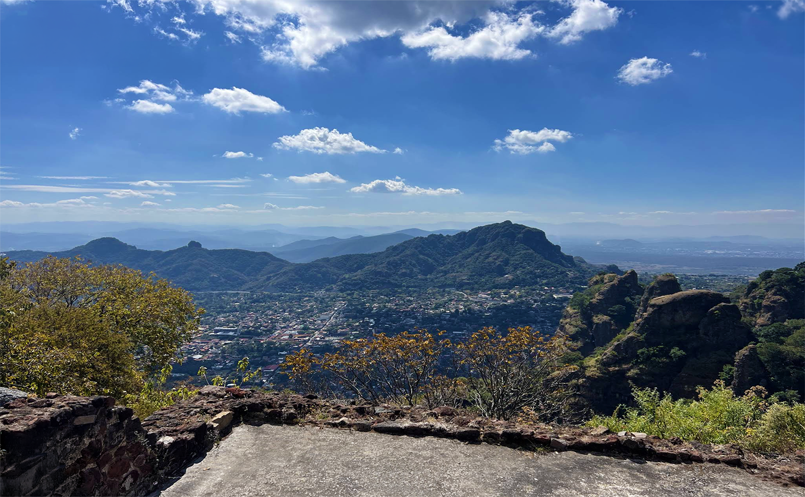
In the middle Postclassic Period, terraces and a small pyramid were built on one of the peaks of the Sierra de Tepoztlan, overlooking the pre-Columbian town of Tepoztlan. Although the cult of Tepoztecatl was local, the temple attracted pilgrims from distant regions, including Guatemala. El Tepozteco’s pilgrimage function, while more regional than sites like Cholula and Tepeyac, still fostered cultural exchange among Mesoamerican communities. Today, the Sierra de Tepoztlan and the temple site are within El Tepozteco National Park, conserving both cultural and ecological heritage.
Around 1200 CE, the Xochimilcas, known as Tepoztecas after their patron god, initiated the construction of the capital of the Tepoztlán dominion on the southern slope of the eponymous mountain range. The construction process involved leveling, cutting, filling, and erecting retaining walls on the slope to create terraces for houses, palaces, temples, and other typical Mesoamerican structures. This urban planning was not only an engineering feat given the steep, rough terrain, but also reflected the social organization and religious beliefs of the inhabitants, as terraces often delineated spaces for different classes and religious functions. The city’s design facilitated defense and control over the surrounding valley, additionally establishing its political significance in the region.
Tepoztlán’s use of terraces to adapt to the mountainous landscape is a notable characteristic, and while it shares features with other major Mesoamerican cities, such as Teotihuacan and Tenochtitlan, there are important differences. Teotihuacan, for example, was constructed on a flat plain and organized around broad avenues and monumental geometry, while Tenochtitlan employed artificial islands and causeways on a lake environment. All three cities incorporated urban planning that reflected social stratifications and religious centers, yet Tepoztlán’s adaptation to steep terrain with terraces set it apart, highlighting the diversity of Mesoamerican approaches to city design.
From a distance, the city may have resembled a pyramidal base, as the retaining walls were smoothed with lime and sand. Excavations have revealed two types of residential areas: simpler units consisting of several independent rooms with a front patio, built on leveled platforms with adobe walls and perishable roofs, likely made from local timber; and more complex units comprising small, interconnected rooms on high platforms accessed by staircases, also featuring front courtyards. The architectural complexity of these units is considered indicative of the occupants’ hierarchical status. Besides residences, evidence suggests workshops and storage facilities, indicating a diversified economy that included craft production, trade, and agricultural storage, supporting the city’s role as a local hub.
The temple of the mythical god Tepoztecatl was established on the summit of a rocky outcrop in the Tepoztlán range. Although the summit was originally flat, it was further leveled and expanded, with platforms and terraces added. The choice of location, high above the valley, represented a closer connection to the divine and enabled the sanctuary to be visible from afar, strengthening the religious and political power of its builders.
Access from the valley involved traveling to the Axitla spring, the civic-religious center of the altepetl of Tepoztlán, and ascending along the ravine to the sanctuary. The sanctuary complex includes four main elements: the temple, its dependencies, the plaza, and the residential area. The temple is situated on a sloping wall base that terminates below the southwest stairway leading to the plaza.
Description
The temple features a square floor plan with two rooms: a larger outer antechamber and a smaller inner chamber. The exterior walls display a talud-tablero profile, with a molding at the base of the tablero. The entrance is porticoed, with two pillars supporting the roof and at least one decorative element embedded in the wall. The inner chamber is defined by two walls decorated with reliefs and a combination of sloping and straight planes. A bench with reliefs extends along the inner walls of both the antechamber and the inner chamber.
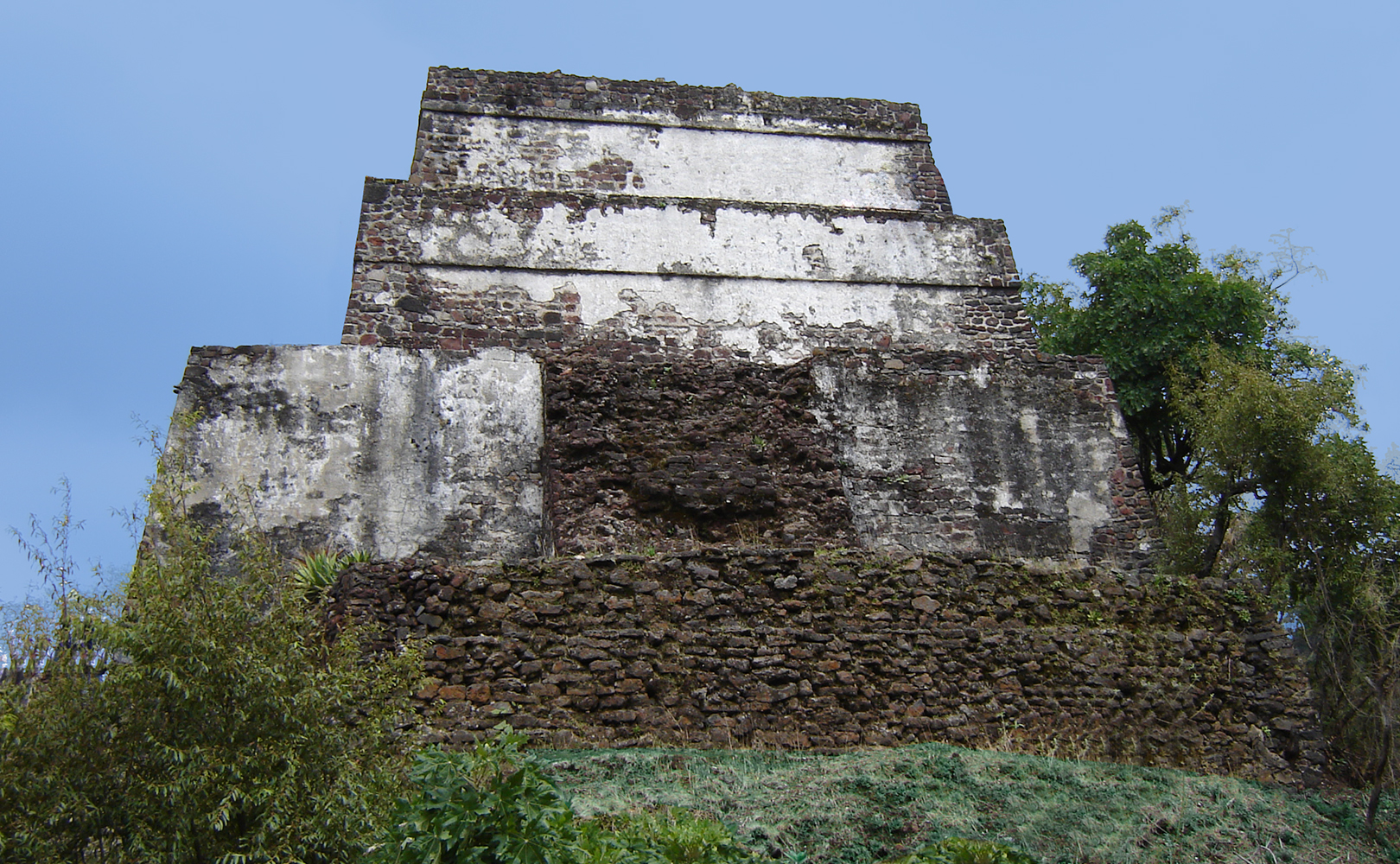
The temple structure consists of a pyramidal base with a west-facing stairway and an east-facing temple chamber. The base is a single section with sloping walls decorated with talud and talud-tablero motifs. The staircase is bordered by balusters, though it is unclear whether pilasters originally topped them, as they were destroyed.
The temple itself stands at the western side of the site. It consists of a 6.4-meter-high platform supporting a 3.3-meter-high temple base. The west facade of this base was later covered during plaza and stairway construction. The first retaining walls for the plaza have disappeared, leaving only exposed fill now contained by earthworks. The plaza contains the remains of an altar in front of the temple.
Upon this stand the remains of the temple building, which now stand 2.7 meters high. The temple was formed of two rooms. The first room opened onto the temple stairs, with two pillars flanking the entrance. In the centre of this room, a small hollow was found, containing traces of charcoal and copal.
The entrance to the small inner sanctum was similarly flanked by two pillars. It is likely that the sculpture of Tepoztecatl was housed in this chamber.
The temple underwent several modifications over the course of its history. The initial alteration involved narrowing the entrance to the inner sanctum by constructing flanking walls against the previously free-standing inner pillars. The most important modification was the addition of stone benches and a small projecting cornice, which features bas-relief depictions of the glyphs for the 20 days of the sacred tonalpohualli calendar.
Dwellings were constructed on the terraces on the eastern side of the site to accommodate resident priests and their assistants. To the east, the eastern stairway rises from a platform whose walls have vanished, with its fill also contained by earthworks. The southeast stairway was constructed to reach this platform level.
Chronological Period
The main chronological period of the site is the Middle and Late Postclassic, from 1200 to 1521 CE. During this era, the site witnessed various phases of construction, renovation, and cultural interaction, especially after the Triple Alliance’s conquest in 1452. Following the conquest, several new architectural features were introduced, most notably the addition of decorated stone benches and a projecting cornice in the temple, both decorated with the glyphs of the 20 days of the tonalpohualli calendar. Glyphs referencing the Triple Alliance and central Méxican traditions, including images such as the turquoise crown and a shield with arrows, were added to the site, indicating the political and cultural influence of the conquerors. These features highlight how El Tepozteco incorporated symbols of the new ruling power, thereby illustrating the site’s developing identity under Triple Alliance dominance.
Interpretations
In the ruins of the temple, two fallen stones bearing glyphs were found; one bears the name of the mythical Méxica emperor Ahuizotl, the other the calendrical date “10 rabbit.” This date marks 1502 A.D., the year of the death of the mythical emperor. The presence of these glyphs has given rise to differing scholarly interpretations regarding the timing and motivation for the temple’s construction and later modifications.

Some archaeologists argue that the temple was built in 1502, citing the calendrical date “10 rabbit” and the name of Ahuizotl as direct evidence that the construction coincided with, or commemorated, his death. According to this perspective, the glyphs serve as a contemporary record of the events and rulers associated with the temple’s founding.
Other researchers contend that these stones were added in a subsequent phase to honor Ahuizotl, possibly as part of a wider program of political or religious commemoration initiated by the Triple Alliance after their conquest of Tepoztlan in 1452. They argue that the glyphs’ placement and the context in which the stones were found suggest a ritual or symbolic addition rather than direct evidence of the earliest construction date.
Further complexity is added by the presence of glyphs such as a turquoise crown and a shield with arrows, which many investigators interpret as symbols associated with the Triple Alliance. These motifs support the idea that major alterations, including the benches, were introduced during the period of Triple Alliance control. Overall, the evidence allows multiple interpretations, and the precise chronology of El Tepozteco’s major structures remains a matter of ongoing scholarly debate.
If you go
El Tepozteco National Park is a national park in Morelos state of central México. It protects 232.58 km² in the mountains of the Trans-Méxican Volcanic Belt. The park includes El Tepozteco, an archeological site featuring an Méxica temple.
Address: Carretera Federal Libre, Cuernavaca – Tepoztlan, 62520 Tepoztlán, Mor.
Plus Code: 2V2X+89 Tepoztlán, Morelos
Drive: 47 min via Carretera Federal Libre Cuernavaca-Tepoztlán/Morelos Cuernavaca – Yautepec de Zaragoza
Entrance Fee: MXN$210 (Approximately US$12.15)
Open 8 am – 3pm Tuesday through Sunday, Closed Mondays and Tuesdays.
Caution: Wear rubber sole walking shoes, wide brimed hat to block the sun.